Welcome To The Village Of Prairie Grove
We are a small community in the Northeastern region of Illinois.
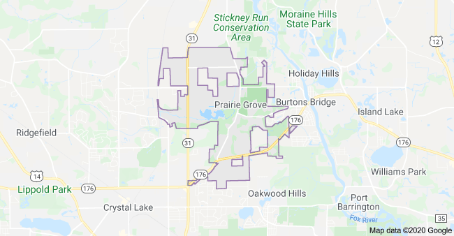
Specifically, the Village is located in Southeastern McHenry County. The closest major intersection is Illinois State Route 31 (North/South) and Illinois State Route 176 (East/West). Neighboring communities include Crystal Lake to the West and South, Burton's Bridge and Island Lake to the East, Cary and Oakwood Hills to the Southeast and McHenry to the North.

| Municipality | 2010 | 2000 | 1990 | Change | Percent |
| Prairie Grove | 1904 | 960 | 654 | 306 | 46.8% |
Males: 473 (49.3%), Females: 487 (50.7%)
Elevation: 760 feet
County: McHenry
Land area: 4.6 square miles
Zip code: 60012
Median resident age: 37.3 years
Median household income: $93,361 (year 2000)
Median house value: $285,800 (year 2000)
Races in Prairie Grove:
- White Non-Hispanic (96.1%)
- Hispanic (1.3%)
- Two or more races (0.7%)
- Black (0.6%)
(Total can be greater than 100% because Hispanics could be counted in other races)
Ancestries: German (33.8%), Irish (18.8%), Polish (12.6%), Italian (9.1%), English (8.2%), Swedish (7.0%).
For population 25 years and over in Prairie Grove village
- High school or higher: 91.0%
- Bachelor's degree or higher: 38.1%
- Graduate or professional degree: 11.8%
- Unemployed: 3.3%
- Mean travel time to work: 32.5 minutes
For population 15 years and over in Prairie Grove village
- Never married: 22.3%
- Now married: 64.6%
- Separated: 0.8%
- Widowed: 4.2%
- Divorced: 8.1%
4.1% Foreign born (2.4% Europe, 1.4% Latin America)
